The “High Country” of North Carolina is the fond name that locals give to the mountains in the extreme western portion of the state. I called this region my home for four fantastic years and countless weekend forays.
The hikes listed below are by no means a complete list, but provide the visitor with a glimpse of the natural beauty the region has to offer.
Editor’s Note: Western North Carolina suffered damage during 2024, so some of these trails may not yet be reopened. Check before you go.
This post contains affiliate links.
Pink Beds

Located in the Pisgah National Forest near the town of Brevard, Pink Beds is a great hike for any visitor to the region. The name “Pink Beds” comes from the beautiful blooms of mountain laurel, azalea, and rhododendron that can be seen through the spring.
The trailhead is near the Cradle of Forestry and has ample parking and good signage, but no restroom. The mellow grade is perfect for hikers young and old, as well as for those interested in getting into trail running.
At my last visit, trail work was being done to improve the boardwalk that goes over marshy sections. Pink Beds trail is a five-mile loop with very little elevation change that can be fit into a nice morning or afternoon hike.
Cone Manor to Bass Lake

Located just off the Blue Ridge Parkway not far from Blowing Rock, The Cone Manor is worth a visit of its own. During the warmer months, it is home to the Parkway Craft Center, which is part of the Southern Highland Craft Guild and boasts genuine examples of local goods from around the region.
Although many fantastic hikes leave from the manor house, one of my favorites is the loop down to Bass Lake and back. Leaving from the house, you can take the trail to the left or right downhill towards the lake.
These gravel carriage trails are well-maintained and easy to follow. Enjoy the hike through rhodo thickets and old orchards. Feel free to take a detour to “the Maze” or the “Apple Barn”.
When you reach Bass Lake, you are halfway and can catch a glimpse of the manor house up above you. You can return the way you cam,e but I recommend taking the other half of the loop.
Black Balsam
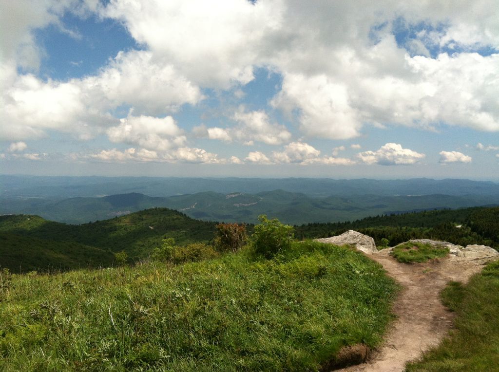
Just off the Blue Ridge Parkway, about an hour south of Asheville, is the little detour that brings you to the Black Balsam Knob trailhead. I happened upon this gem by accident one day and have found myself here countless times since.
From the parking lot, equipped with pit toilets, I recommend taking the Art Loeb Spur trail straight up to the ridgeline. This trail is moderate to difficult in sections until you reach the top.
At this point the Art Loeb Spur intersects with the actual Art Loeb Trail, take it to the left to climb to the actual ridgeline. The great thing about the Black Balsam area is the opportunity for 360-degree views.
Walk as far as you want with the time you have. Perhaps bag the Black Balsam summit at 6,214 ft and Tennent Mountain at 6,046 ft before returning the way you came.
A note to hikers: the Black Balsam area can be very windy and violent storms can roll in with very little notice, so always come prepared for the extremes.
Rough Ridge
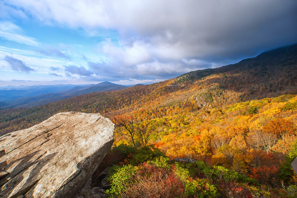
Located south of Boone on the Blue Ridge Parkway, Rough Ridge is a much-loved trail for locals and visitors alike. This trail affords incredible views and a chance to see rare plant life.
From the Rough Ridge trailhead climb steeply past the intersection with the Tanawha trail up towards the first boardwalk. This boardwalk provides you with a good place to take a breath as well as protects the fragile native flora from your boots.
Continue up the trail for several switchbacks until you reach the summit. Enjoy the breeze as well as the views down towards Lenoir and Hickory and up to the peaks on Grandfather Mountain.
The trail is about a mile one way and gains a considerable amount of elevation in this time. Plan on taking your time if you are a less experienced hiker. Visitors should note that dogs are not allowed on the Rough Ridge trail due to the very rare plant life in the area.
Profile Trail
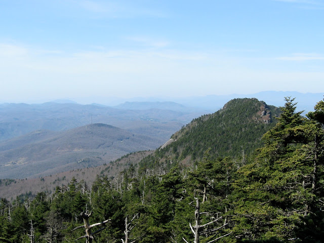
This is by far one of the best hikes in the High Country. It is also one of the more difficult hikes in the Banner Elk area. Just off from Highway 105 at the base of Grandfather Mountain is the trailhead for the Profile Trail.
This trail is named for the view of the “Grandfather’s” profile you will gain along the way (another profile is visible from Hwy 105 coming from Boone, but the one on the trail is said to be the “true” profile).
Starting in the creek bed the trail gradually switchbacks through beautiful high country forests for several miles. Sometime after mile two the trail drastically changes.
The switchbacks become much shorter and the ground goes from compacted dirt to a bit of a rock scramble. Continue on the Grandfather Trail for another mile when you will reach a split for Calloway Peak.
Take the Calloway Trail to bag the highest peak on Grandfather Mountain (5,946 ft). One of the coolest things about this area is that the ecosystem on top of Grandfather is more closely related to a Canadian Alpine ecosystem.
Breathe deeply and you will enjoy the festive smell of fir trees. For a more mellow hike, take the profile trail to the bench at the profile view then return to your car.
For a more intense option, bag Calloway then descend via the Daniel Boone Scout trail; arrange for a car to pick you up on the east side of the mountain on the Blue Ridge Parkway.
Pickens Nose

Set just across the state line from Georgia in Otto, the access point is from a rocky forest service road popular with hunters. There’s room for one to two cars at the top and a sign that indicates the path. It’s not a long trail, no more than 20 minutes to reach, but the rock outcropping has one of the best sunrise views around. Some areas of the hike are rocky, following the spine of the bald, while others are shaded in thick trees.
Honorable Mentions
- Wilson Creek Wilderness– This is my favorite backpacking area in North Carolina, but is full of good day hikes and a number of waterfalls.
- Linville Gorge Wilderness– It’s one of the biggest gorges east of the Mississippi. Hike to the bottom or stay along the rim, either way you’ll enjoy yourself.
- Montreat Trails– Some of the closest hiking from downtown Asheville with something to offer every skill level.
- Max Patch– A popular detour from the Appalachian Trail, this bald west of Asheville provides fantastic views with minimal commitment. Bring a picnic or a kite.
For more specific mileage info check out Leonard M. Adkins’ Hiking and Traveling the Blue Ridge Parkway: The Only Guide You Will Ever Need, Including GPS, Detailed Maps, and More (Southern Gateways Guides) on Amazon.
PIN IT


All photos are property of the author. If you have any questions about the hikes and trails listed in this post, leave them in the comments below.

Do you have any hiking recommendations for lower in the Appalachian Mountains or good sites to refer to? I am an intermediate hiker and I don’t know much about hiking outside of the VA/NC area.
Sure thing! If you’d like to check out the post on “Best Hikes in Georgia” I mention two of my favorite hikes in the lower Appalachians. Blood Mountain, which is actually on the Appalachian Trail provides some of the best views in North Georgia. You could always hit up Springer Mountain, which is famous for being the starting point of the AT. Mount Yonah has a fun rock face which allows for some fun scrambling as well as a bald which would be good for stargazing; and nearby Helen is always fun for a laugh. Other great places in Georgia would be the Panther Creek area and nearby Tallulah Gorge. Jacks River Falls in the Cohutta Wilderness is a personal favorite as well. DeSoto State Park in northern Alabama is nice for a day hike. Beyond that, anything in the Brevard vicinity in North Carolina is fantastic. Dupont forest is great for seeing waterfalls, although the hikes have become more popular since portions of the Hunger Games were filmed there. Pisgah as a whole has great hikes from virtually any trailhead. I also can’t say anything but good things about the hiking in the Smokies. Spend as much time here as you can allow. There are some fun mountains to climb as overnighters, great day hikes, and lots of history. Also it has the most salamander biodiversity in the world. I have several southern hiking books that I like to use but to know mileage for a new trail I typically just hit up trails.com. Hope this helps!