Rail lines once connected much of the South, from Flagler’s train down the length of Florida to the Amtrak Crescent Line that still runs in a curve down the coast to New Orleans.
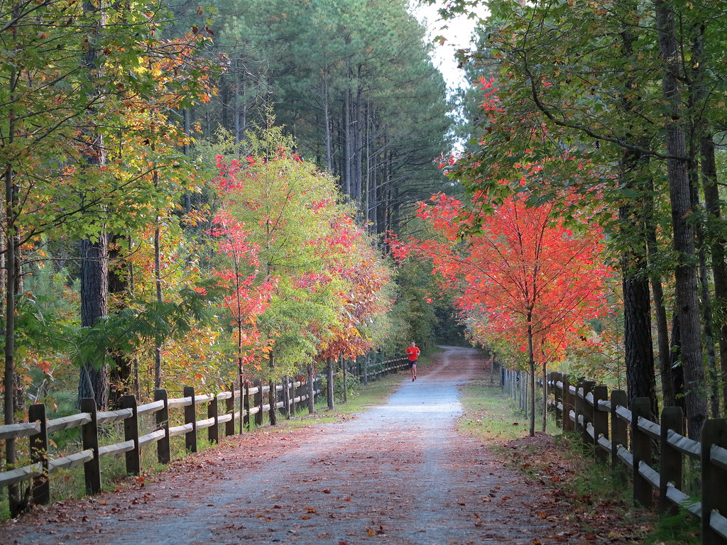
But what happens when these tracks are no longer in use? Many communities have converted them to rails-to-trails paths, public spaces with parks, restaurants, and access to public transportation along the way.
This post contains affiliate links.
Silver Comet/Chief Ladiga Trail, Alabama and Georgia

Named for the Silver Comet passenger train that ran from 1947 to 1959, the 94-mile rail-trail runs between Smyrna, Georgia, a suburb of Atlanta, and Anniston, Alabama. In Alabama, it becomes the Chief Ladiga Trail.
The Silver Comet is the second-largest paved rail-trail in the nation. The Georgia section was built in 1998, and it was connected to the Alabama section in 2008. Plans exist to connect it to the Atlanta Beltline, making it even longer.
Cyclists enjoy the relatively flat, paved trail, but it’s also nice for families looking to stretch their legs. Along the way, the trail passes mill ruins and rail trestles from its former life. You can also stop along the way and spend the night in towns like Cedartown and Jacksonville.
Delta Heritage Trail, Arkansas
The Delta Heritage Trail, within its namesake state park, is a planned 73-mile rails-to-trails path along an abandoned stretch of Union Pacific Railroad track.
The section in Helena opened in 2002, and there are currently 44 miles open to visitors. The trail follows the Mississippi River levee and passes through towns like Arkansas City, Rowher, and Barton.
There are eight trailheads, including four with restrooms. The state park also has campsites offering overnight accommodations.
Pinellas Trail, Florida
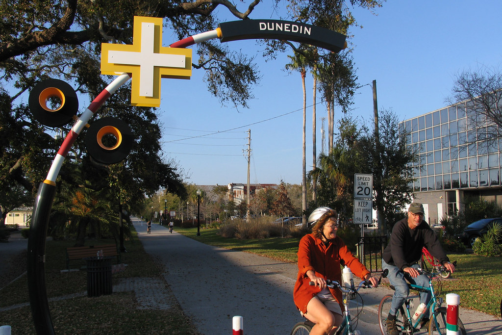
Following the former Seaboard Coast Line Railroad route, the Pinellas Trail runs 45 miles between Tarpon Springs and St. Petersburg, Florida. The first section opened in 1990.
The paved path is popular with cyclists and walkers and is even used as a form of public transportation. Plans will extend the trail another 30 miles.
The Beltline, Georgia

The Atlanta Beltline is considered to be one of urban planning’s biggest success stories, which started as a 1999 graduate student project. It turned a disused Western-Atlantic rail corridor into 22 miles of trails.
Opened in 2013, the ever-expanding trails have created desirable neighborhoods with paved paths, access to public transportation, parks, restaurants, and shops like those at Ponce City Market. There are bike rentals along the way as well as wheelchair access.
Plans will continue further throughout the city and connect to other trails, like the Silver Comet Trail, along with a streetcar that follows the same route.
Dawkins Line Trail, Kentucky
Set in Northeastern Kentucky, the Dawkins Line Trail was built on a 1912 Big Sandy and Kentucky River Railroad rail line. It first opened in 2013 for cyclists, hikers, and horseback riders. Today, it runs 18 miles between Hagerhill in Johnson County to Royalton in Magoffin County.
Along the way, it passes over 20 former railroad trestles and even a 600-foot tunnel. It’s made of crushed stone and wooden platforms. Plans will extend the trail to 36 miles in total, and it is the longest rail-trail in Kentucky.
Tammany Trace, Louisiana

The Illinois Central Railroad line once ran through Louisiana, but today it’s the Tammany Trace, a 31-mile trail. The path connects the communities between Covington and Slidell, located on the Northshore of Lake Pontchartrain, just above New Orleans.
The Trace is paved and wheelchair accessible, has restrooms, and has parking nearby if you want to see it in sections. Borrow a bike from Brooks’ Bike Shop or even see one section on horseback.
Be sure to detour to the Abita Brewpub, the brewery’s first location. The quirky Abita Mystery House and the lakefront in Mandeville are also must-sees. Stay at one of the inns or the nearby Fontainebleau State Park.
Tanglefoot Trail, Mississippi

The Gulf and Ship Island Railroad began operations in northern Mississippi in 1871, following a Native American path traversed by Meriwether Lewis and Hernando DeSoto. The Tanglefoot was one of the trains that made the journey.
In 2013, the Tanglefoot Trail opened as a paved path connecting the towns of New Albany, Ecru, Pontotoc, Algoma, New Houlka, and Houston, over 43 miles. These communities are home to historic landmarks, restaurants, and even accommodations.
American Tobacco Trail, North Carolina
In 1905, several rail lines were constructed in the modern-day Research Triangle of North Carolina to service the tobacco warehouses of companies like Lucky Strike. Called the New Hope Valley Railway, it was purchased by Norfolk Southern and discontinued in the 1970s.
Today, the American Tobacco Trail runs from Durham and passes the Durham Bulls stadium and the restaurants and shops of the American Tobacco campus before continuing 22 miles to Cary.
There are water stations, restrooms, and parking along the path, which is paved in some sections and rocky in others.
Swamp Rabbit Trail, South Carolina

The nearly 20-mile Swamp Rabbit Trail was created through a defunct Greenville & Northern Railway shortline, connecting downtown Greenville to Travelers Rest.
It was abandoned by 2005 and opened as a paved public walking trail, both pet-friendly and wheelchair accessible, by 2009. Start your journey downtown at Falls Park on the Reedy, continuing to the campus of Furman University.
See the path on foot or borrow a bike from the B-Cycle bike share program. Pick up a snack like hearty sandwiches and wood-fired pizzas at Swamp Rabbit Cafe & Grocery, located right on the trail, or crepes at Tandem Creperie. You can even sip local craft beer at Swamp Rabbit Brewery.
Shelby Farms Greenline, Tennessee

Set in one of America’s largest parks, Shelby Farms in Memphis boasts 4,500 acres. The former private farm was turned into a public space in the 1970s.
One interesting feature is the Shelby Farms Greenline, which opened in 2010 on a decommissioned CSX rail line. The 10-mile path is the largest trail in the Memphis area. There are bike rentals and repair stations along the way.
Creeper Trail, Virginia

The Virginia Creeper Trail follows the route of a Native American footpath that was traversed by Daniel Boone. From 1900 and 1977, a rail line of the same name traveled the route between Abingdon and Damascus.
These days, the path is a 34.3-mile mostly paved path from Abingdon to the North Carolina state line. It is flat and wooded in some sections and hilly in others.
Along the way, you’ll pass former train depots and residences as well as Abingdon Vineyards. It also goes near the Appalachian Trail, passing over converted rail trestles.
Local outfitters provide bike rentals and shuttle services if you only want to go one way. There are also inns and hotels in many of the towns along the path.
What to Pack for Navigating Rails-to-Trails Paths
Bring a few essentials with you while traversing the South’s rails-to-trails paths. If you’re exploring by bike, be sure to bring a helmet, sunscreen, a water bottle, and snacks. You may also want to bring some money in case you want to stop for a snack along the way.
Have you been to any of these trails?
PIN IT


I dont think much of the Virginia Creeper trail is actually paved. The downhill section into Damascus is very popular and probably 90 percent of the riders take a shuttle van up the mountain then coast downhill to Damascus. The section from Abingdon to Damascus is nice but less traveled to say the least. Anyways this is a great trail very beautiful